
Top hikes in Macon County
Andy Scheidler
sports@thefranklinpress.com
While many businesses might be shut down, nature is still wide open.
We’re lucky to call the mountains home, which feature ample opportunities to enjoy the great outdoors.
As life has evolved into unchartered territory, it’s a great time to get out on a trail and explore some unchartered territory in nature.
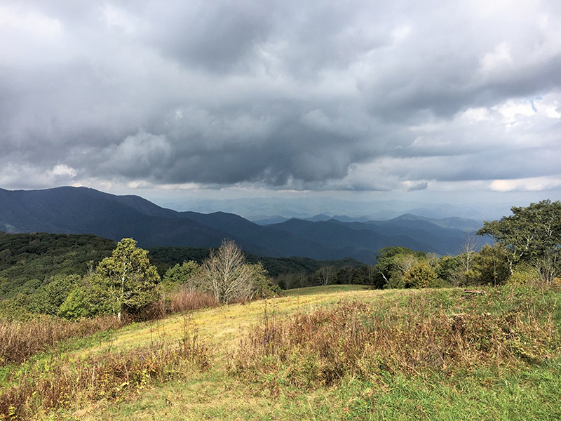
Wayah Bald
If you’re feeling more adventurous and want to hike to Wayah Bald, rather than drive up to it, then a challenging jaunt awaits.
From Franklin, take Old Murphy Road or U.S. 64 to Wayah Road. Climb up the mountain and park along the road where the gravel road begins to wind up to Wayah Bald, or across the road at the Siler Bald parking lot.
Get on the Appalachian Trail and hike 4.2 miles to the peak. It’s a strenuous hike, with a round-trip elevation gain of approximately 2,000 feet. But it’s a much more rewarding way to enjoy the stunning view than simply getting out of your vehicle.
Siler Bald
The parking lot for Siler Bald is directly across Wayah Road from a gravel road that climbs to Wayah Bald.
This hike is also on the AT, but you’ll be going the opposite direction from Wayah. It’s a much shorter and friendlier route, at approximately four miles round trip. And it’s a gradual incline – until you reach the bald.
The final few tenths of a mile will make your lungs and legs burn. But you won’t notice it as much because the panoramic vistas will open up as you climb the bald to the top.
At 5,208 feet, the peak is just under a mile high. You’ll be rewarded with a nearly 360-degree view, which includes Nantahala Lake.
Standing Indian via Deep Gap
Leave Franklin and head west on U.S. 64 to Deep Gap Road. It’s located on your left, not far past Winding Stair Gap. You’ll take a Forest Service road that dead ends at the Deep Gap parking lot.
This hike is approximately 5 miles round-trip. For hiking grades, it probably deserves between a “medium” and difficult” rating. Elevation gain is a little over 1,000 feet.
At the top, you’ll get an expansive view of the valley below. At 5,499 feet, Standing Indian is the highest peak in Macon County.
Wesser Bald
Want to hoof it on the AT but with a much shorter hike? Then this is probably your best bet.
The downside to this option is you might spend more time driving than hiking.
Take N.C. 28 north to Tellico Road. It’s paved until it turns into gravel as you wind your way to the top.
From the parking area, it’s only 1.3 miles to the peak. Fair warning though: you’ll still gain more than 700 feet in that short distance. Just remind yourself that the views are more rewarding if you’re sweating.
The peak features a fire tower and an incredible 360-degree view.
Yellow Mountain
Here’s another option to see one of Macon County’s five fire towers.
Take U.S. 64 south like you’re headed to Highlands. Turn onto Buck Creek Road. After approximately 8.8 miles, you’ll park alongside the road at the trailhead.
This is the longest of the hikes listed here, with a round-trip distance of approximately 12 miles. Which means you’ll get a mix of occasional flat sections to go with the inclines.
Pat yourself on the back after checking this hike off your to-do list, because you’ll have earned it.
Prime hiking regionally
Chattooga River Headwaters
The Upper Chattooga River is a wonderful area to head out into the backcountry along a network of trails. Following Bull Pen Road from N.C. 107 South, visitors will find parking in dozens of pull-offs.
A large iron bridge stands as a landmark for newcomers and marks the start of multiple trailheads. These trails are an intermediate hike, but maps are recommended as many switchbacks can create confusion.
Gorges
Gorges State Park, located along N.C. 281 South from U.S. 64 East, has one of the most extensive network of trails in the area, with various hikes for all-level hikers.
Gorges offers more than 125 rare plants, long-distance views from cliffs and multiple waterfalls to enjoy. Rainbow Falls is one of the most popular sites at 150 feet.
Hikes range from intermediate to strenuous, but ongoing improvements make the park easily accessible for large groups, and informational maps at trailheads and along paths make navigation fairly easy.
Panthertown
Panthertown Valley, located off of U.S. 64 East, is perhaps the top trek on the Highlands-Cashiers plateau. This 6,300-acre backcountry tract pushing deep into the Nantahala National Forest has more to offer than could ever be viewed in a day. From waterfalls to a rare Appalachian bog, it is a diverse ecological site in the Appalachian high country.
Raven Rock, Schoolhouse and Greenland Creek falls are all popular water features. Trails range from intermediate to strenuous and maps, which can be purchased at most outdoor stores in the area, are highly encouraged.
Silver Run Falls
A parking area for Silver Run Falls is located on N.C. 107, four miles south of the crossroads. Within 100 yards of the parking area, visitors can take a break on large boulders and watch Silver Run Creek pour over a 25-foot drop into a deep pool. This attraction is extremely family-accessible and offers a touch of the wild even for those unable to venture out into the wilderness.
Whitewater Falls
Whitewater Falls is perhaps the most easily accessible large waterfall in the area. Located on N.C. 281 South, from U.S. 64 East, a large parking area accommodates groups and within a few hundred feet visitors can view the 411-foot falls from a large viewing platform.
This is the highest waterfall east of the Rockies, and a heavily maintained trail makes access easy for everyone.
Whiteside Mountain
A network of fairly easy trails along Whiteside Mountain is definitely one of the local favorites for hikers. With a parking area located off of U.S. 64 West, between Cashiers and Highlands, visitors can take a tromp down a loop trail that offers long-distance views from the 750-foot cliffs.
These trails are intermediate-level hikes. However, a well-maintained trail and a medium-level grade make the hike accessible for most.
The Cashiers area also offers many hikes for intermediate and high-level hikers. From the intermediate trails through Whiteside Mountain and along the Chattooga River, to rough trails through Gorges State Park and Panthertown Valley, the area offers a little bit of everything.
Note: While the Appalachian Trail Conservancy has recommended that hikers postpone all section or thru-hikes, as of March 20 there was no ban on taking the trail for short distances to connect to other hiking trails.